Mapping drones and UAVS
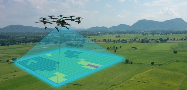
Mapping drones and UAVs are specifically designed for mapping, surveying, and geospatial data collection. They often come equipped with specialized sensors and software to capture high-resolution imagery, perform aerial surveys, create 3D models, and generate accurate maps. Here are some key aspects of mapping drones and UAVs:
- Sensors:
- RGB Cameras: Capture standard color imagery suitable for creating visual maps and orthophotos.
- Multispectral Cameras: Capture imagery in multiple spectral bands (e.g., near-infrared, red, green, blue) for vegetation analysis, crop health monitoring, and environmental assessment.
- LiDAR (Light Detection and Ranging): Utilize laser pulses to measure distances and create detailed 3D point clouds, suitable for terrain modeling, elevation mapping, and infrastructure assessment.
- Thermal Cameras: Capture thermal infrared imagery for heat mapping, building inspections, and search and rescue operations.
- Software:
- Mapping and Photogrammetry Software: Process drone imagery to create orthophotos, digital elevation models (DEMs), point clouds, and 3D models. Examples include Pix4D, DroneDeploy, and Agisoft Metashape.
- GIS (Geographic Information System) Software: Analyze and visualize geospatial data, perform spatial analysis, and create maps. Examples include ArcGIS, QGIS, and Global Mapper.
- Flight Planning and Control:
- Autonomous Flight: Mapping drones often feature autonomous flight capabilities, allowing users to plan missions, set waypoints, and automate data capture.
- Real-time Monitoring: Monitor flight progress, camera settings, and battery life in real time using ground control software or mobile apps.
- Accuracy and Resolution:
- Mapping drones are designed to achieve high accuracy and resolution in data capture, essential for creating precise maps and survey results.
- Factors influencing accuracy include sensor quality, GPS accuracy, ground control points (GCPs), and post-processing techniques.
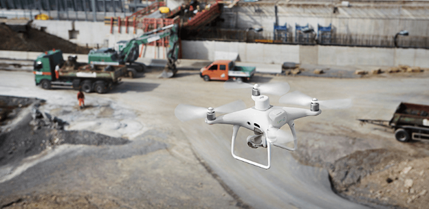
- Applications:
- Topographic Mapping: Create detailed topographic maps for land surveying, urban planning, and engineering projects.
- Orthophoto Generation: Generate orthophotos (georeferenced aerial images) for accurate visualization and analysis.
- Volume Calculation: Calculate volumes of stockpiles, earthworks, and terrain changes using drone imagery and 3D modeling.
- Asset Inspection: Inspect infrastructure assets such as roads, bridges, pipelines, and buildings using drone imagery and LiDAR data.
Mapping drones and UAVs offer efficient and cost-effective solutions for a wide range of mapping and surveying applications, providing valuable data for decision-making and resource management.