
Map design and production
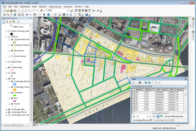
Map design and production involve several key steps to create effective and informative maps:
- Define Purpose and Audience: Start by understanding the purpose of the map (e.g., navigation, analysis, visualization) and the target audience (e.g., general public, professionals, specific stakeholders).
- Gather Data: Collect relevant spatial data such as geographic features, boundaries, points of interest, and attribute data (e.g., population, land use) from various sources including satellite imagery, surveys, and public databases.
- Choose Software: Select a suitable GIS or mapping software based on your needs and expertise level, such as ArcGIS, QGIS, or others mentioned earlier.
- Create Base Map: Use the software to create a base map by adding layers, such as roads, rivers, land use, and topography, to provide context to the map.
- Symbolization: Choose appropriate symbols, colors, and styles to represent different features on the map, ensuring clarity and readability. Consider using legends and labels to explain symbols and features.
- Data Analysis and Visualization: Utilize GIS tools for spatial analysis, such as overlay analysis, proximity analysis, and statistical analysis, to derive meaningful insights from the data. Visualize analysis results using thematic maps, charts, and graphs.
- Layout Design: Design the layout of the map, including the size, orientation, margins, and scale. Arrange elements such as title, legend, scale bar, north arrow, and annotations in a clear and organized manner.
- Review and Edit: Review the map for accuracy, completeness, and visual appeal. Make necessary edits to improve clarity, consistency, and overall quality.
- Export and Production: Export the map in a suitable format (e.g., PDF, image file) for printing or digital distribution. Consider factors like resolution, color mode (RGB or CMYK for printing), and file size.
- Quality Assurance: Conduct quality assurance checks to ensure that the final map meets the intended purpose, is free of errors, and effectively communicates the desired information to the audience.
By following these steps and leveraging the capabilities of GIS and mapping software, you can create well-designed and informative maps for various application.