
High resolution drone and satellite imagery
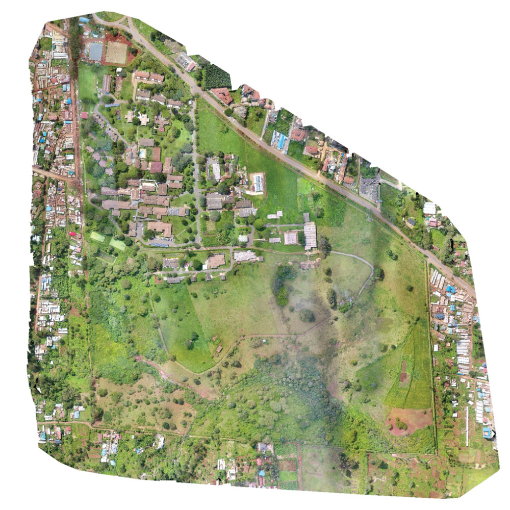
High-resolution drone and satellite imagery are valuable tools for capturing detailed and up-to-date visual information about the Earth’s surface. Here are key aspects of both technologies:
- High-Resolution Drone Imagery:
- Purpose: Drones (Unmanned Aerial Vehicles) equipped with high-resolution cameras are used to capture aerial imagery with exceptional detail and accuracy.
- Applications:
- Mapping and Surveying: Drones are used for land surveys, topographic mapping, and creating digital elevation models (DEMs).
- Infrastructure Inspection: They are employed for inspecting buildings, bridges, pipelines, and other structures.
- Agriculture: Drones aid in crop monitoring, yield estimation, and pest/disease detection.
- Real Estate: They provide high-quality aerial photos and videos for property marketing and assessment.
- Environmental Monitoring: Drones help in monitoring ecosystems, wildlife, and natural disasters.
- Advantages:
- Flexibility to capture imagery on-demand and in areas where access is challenging.
- High-resolution imagery with detailed spatial information.
- Cost-effective compared to traditional aerial surveys using manned aircraft.
- Ability to capture multispectral and thermal imagery for advanced analysis.
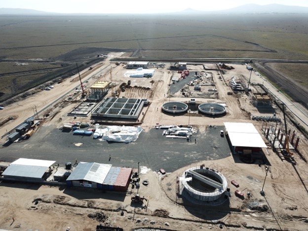
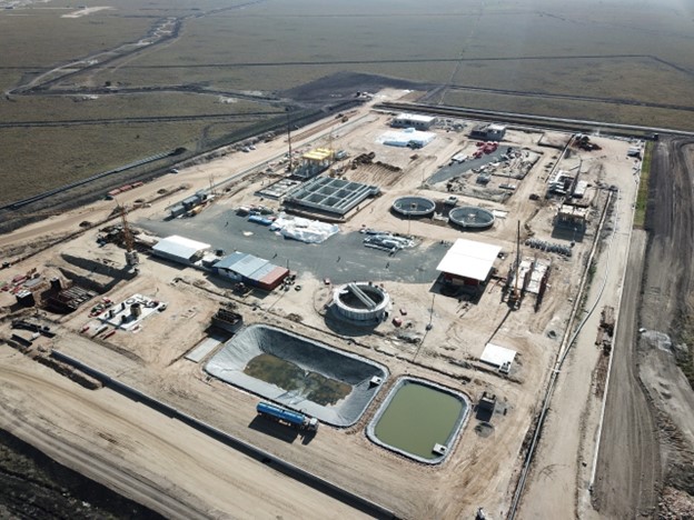
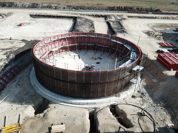
- High-Resolution Satellite Imagery:
- Purpose: Satellites equipped with advanced sensors capture high-resolution imagery of the Earth’s surface from space.
- Applications:
- Remote Sensing: Satellite imagery is used for environmental monitoring, land use classification, and vegetation analysis.
- Urban Planning: It aids in urban growth monitoring, infrastructure planning, and disaster risk assessment.
- Natural Resource Management: Satellite data helps in monitoring water resources, deforestation, and climate change impacts.
- Defense and Security: Satellites provide surveillance and reconnaissance capabilities for military and security purposes.
- Navigation and Mapping: Satellite imagery contributes to GPS navigation systems and digital mapping platforms.
- Advantages:
- Wide coverage area, making it suitable for regional and global monitoring.
- Regular and consistent data acquisition for temporal analysis and change detection.
- Availability of multispectral and hyperspectral imagery for various applications.
- Access to historical archives for studying long-term trends and patterns.
Both high-resolution drone and satellite imagery play critical roles in various sectors, offering unique advantages depending on the specific requirements of the project or application. Integrating these technologies with GIS and mapping tools enhances their utility for data analysis, visualization, and decision-making.